
See where to look
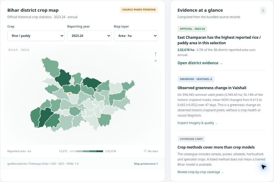
Move from regional context to a focused area of interest.

SATELLITE INSIGHT. GROUNDED DECISIONS.
A clearer picture of agriculture.
A more informed next step.
Bring satellite observations, crop records and field review into one connected workspace. Built for the people making decisions across agricultural landscapes.

Government agriculture departments
/Public agencies
/Agri-enterprises
FROM SCATTERED DATA TO A SHARED PICTURE
The view from above matters.
So does the context on the ground.
A satellite image, a district record and a field observation each tell part of the story. Aakash Drishti CMI brings them together so your team can explore an area, investigate a change and document what happens next.
Move from regional context to a focused area of interest.
Compare dated observations with their quality and sources in view.
Connect evidence to field verification and an accountable review.
THE PRODUCT EXPERIENCE
Explore the regional picture.
Open an area case.
Follow the evidence.
Explore agricultural records and map-based comparisons.
Inspect dated observations and the footprint they cover.
Keep findings, verification needs and review history connected.
REAL OBSERVATIONS. VISIBLE CONTEXT.
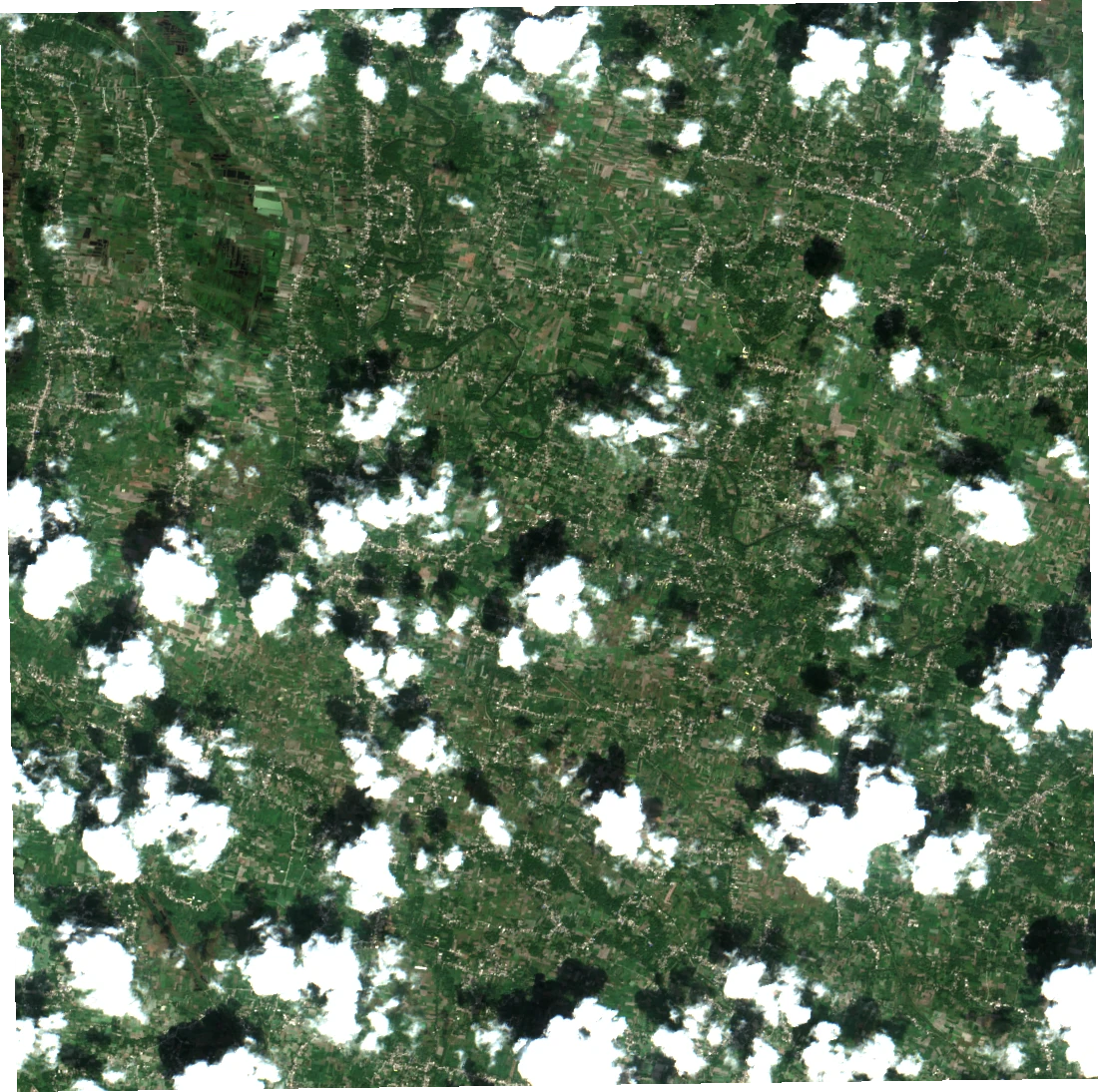
See the source imagery behind a change.
Know when it was observed.
Understand where it is usable.
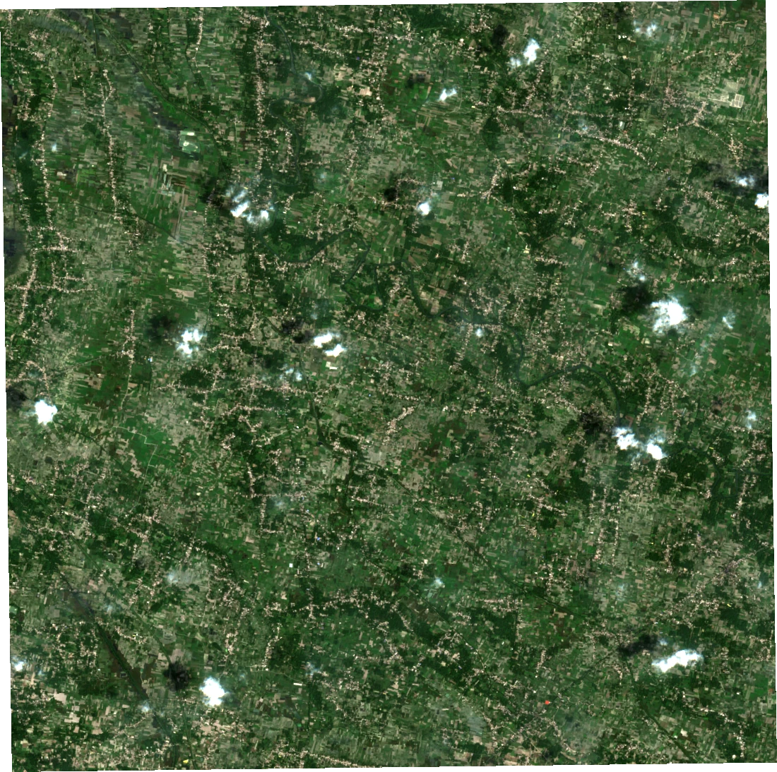
A real sample, with real limits. Vaishali, Bihar is one demonstration landscape. Clouds and usable-pixel coverage affect comparison. Greenness change alone does not establish crop identity, damage, disease or yield.
Contains modified Copernicus Sentinel data (2026), accessed through Element 84 Earth Search. Display images are public demonstration exports; detailed workspace data requires sign-in.
FROM IMAGERY TO EXPLANATION
The evidence workspace puts dated imagery, quality checks and calibrated vegetation observations side by side. Review the usable area before interpreting a change.
See the evidence workflow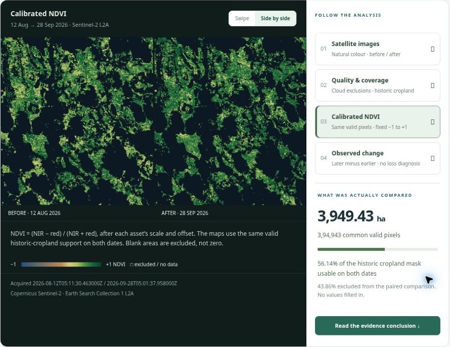
A WORKFLOW THAT FOLLOWS THE QUESTION
Start with the regional picture and available records.
Select an area and open its evidence-led case.
Compare observations and inspect their limitations.
Bring field context into a documented next step.
BUILT AROUND YOUR MANDATE
Start with a defined geography, a clear question and the evidence needed to answer it.
Bring regional records, area investigations and district review into a common working picture.
Discuss your programmeScope a monitoring programme around your mandate, with transparent data coverage and verification requirements.
Discuss your programmeExplore how dated landscape observations can support field prioritisation and operational review.
Explore your use caseCrop identification, damage assessment and yield intelligence are proposed model-led capabilities. Deployment requires suitable local data, ground truth and validation for the intended decision.
Spatial intelligence.
Practical implementation.
A PRODUCT BY ANY TECH VENTURES
We bring together geospatial technology, data and application workflows. Begin with a focused demonstration, agree the evidence and validation requirements, and shape a deployment around your team.
Meet Any Tech VenturesSEE WHAT’S POSSIBLE FOR YOUR REGION